Road worries: the trip from St. Petersburg to Moscow may be reduced to two hours
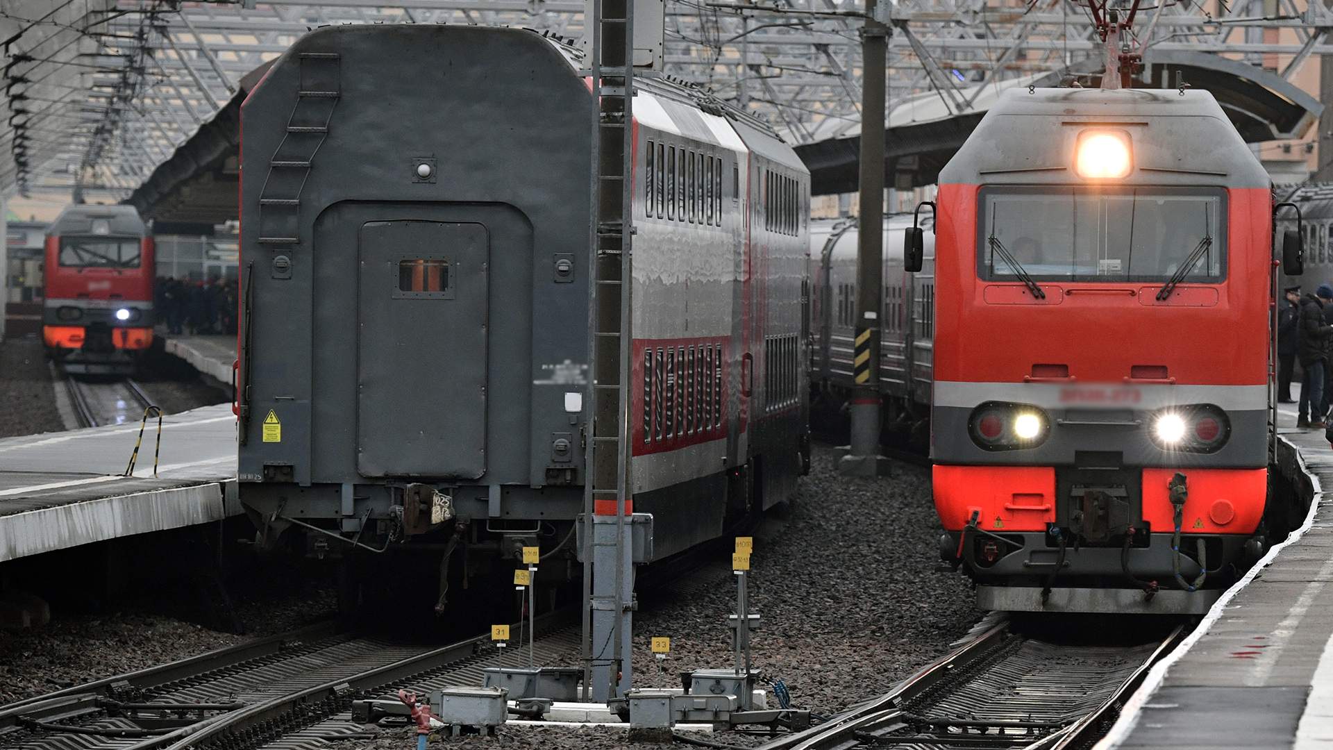
A technology that will allow tracking the slightest shifts and changes in the location of infrastructure elements of a high-speed railroad has been developed at the Russian University of Transport. The authors hope that it will be used in the construction and monitoring of the VSM-1 - a new route that will connect Moscow and St. Petersburg and will make it possible to cover the distance between them in about two hours from 2028. Russian Railways told Izvestia that no decision on the use of the technology has been made yet, but the company is considering all innovative proposals. How the development will help in the construction of railroads, what is new in it and where, in addition to VSM-1, it can be applied, - in the material "Izvestia".
Monitoring of long distances
In Russia created a technology that will allow to identify any minimal deviation in the coordinates of railroad infrastructure objects - including at great distances. It was developed at the Advanced Engineering School (AES) "Academy of High-Speed Railway" of the Russian University of Transport (MIIT) and presented at the scientific and technical council of JSC "Russian Railways". The authors are confident that it can be used in the near future during the construction and subsequent operation of the High-Speed Railway-1 - a high-speed highway between Moscow and St. Petersburg.

Construction of the main section of the new railroad is scheduled for 2025, delivery and launch of traffic - for 2028. Trains capable of speeding up to 400 km/h will run along this main line. As a result, the distance between Moscow and St. Petersburg trains will be able to cover in a little more than two hours. Funds for the construction will be allocated by the National Welfare Fund, it should require 1.7 trillion rubles.
TheMoscow-St. Petersburg high-speed railroad construction project is now at the stage of comprehensive elaboration, the press service of Russian Railways told Izvestia: technical solutions that will meet safety requirements are being developed for it.

"The project involves wide production cooperation, participation of many engineering and production teams," the company added. - Russian Railways is considering all proposed innovative technologies that will improve project efficiency, safety, reliability and reasonable cost savings."
The NSP technology will be based on high-precision geodetic data that will be continuously collected in real time, which will ensure control over construction at all its stages, said Dmitry Manoilo, head of the engineering school.

- The main innovation of the development is the use of a unified coordinate system and automated methods of geodetic measurements of the position of the high-speed rail infrastructure objects," he added. - This will allow to accurately track deviations in the coordinates of railroad infrastructure objects, such as track structure (part of the track that takes the load from the wheels of the rolling stock. - Ed.), earth bed and artificial structures throughout the life cycle of the main line.
Dmitry Manoilo explained that the new high-speed track will function in conditions of temperature variations, various geological conditions in different territories, so it is important to monitor as accurately as possible during operation, to what extent all the indicators are in the same condition in which they were designed and built. So, according to him, the technology will be in demand even after the construction is completed.
Independence from foreign analogs
Ruslan Permyakov, Deputy Director of the NTI Competence Center "Trusted Interaction Technologies" based at the Tomsk State University of Control Systems and Radioelectronics , called the proposed technology unique, explaining that it can provide a comprehensive approach and take into account the specifics of Russian geography, climate, and work requirements for high-speed highways.

High-speed rail project on the stand
- The main thing here is the combination of satellite and inertial data (a reference frame in which free bodies move straight and uniformly. - Ed.) to achieve high accuracy of coordinate measurements in real time, - explained Ruslan Permyakov. - The inertial system compensates for temporary losses or errors of the satellite signal, for example, when passing under bridges, in tunnels or in conditions of strong interference. Satellite data provides global reference to a single coordinate system.
Alexander Rodin, a leading expert of the Competence Center of the National Technological Initiative "Artificial Intelligence" on the basis of MIPT, believes that the technology of a mobile module based on a combination of satellite navigation data and inertial systems is not new in itself.
- But it is very timely in the conditions when Russia has finally started construction of the first high-speed railroad," he said.
There are companies on the world market that produce similar solutions for high-precision geodetic work and monitoring of construction projects, Ruslan Permyakov noted.
- Each of these systems is focused either on geodetic surveying or on monitoring the condition of rail strings in a relative format," he said.
The use of coordinate systems to build a digital twin of the railway infrastructure will ensure the independence of the monitoring system from foreign analogs, believes Dmitry Arkhipov, head of the technological consulting direction of the STI Big Data Central Committee based at Lomonosov Moscow State University.

According to him, foreign railway companies are actively using a combination of satellite data and information modeling technology to monitor the condition of railway infrastructure facilities. He named ArcGIS GeoBIM (Network Rail operator), Sensors4Rail (Deutsche Bahn company) and Railway GIS (Japan Railways company) as the closest analogs to the new Russian development.
- In terms of accuracy, the Russian development is on parity positions, and taking into account the operating conditions, it is possible that it will be ahead of foreign analogs," he believes. - This system can significantly optimize the process of railway construction by reducing the time for checking the quality of track laying, but most importantly, the system can improve traffic safety by predicting the wear and tear of the track and forming recommendations for its repair.
Digital twin concept
One of the features of the proposed Russian technology is the concept of a digital twin, said Dmitry Manoilo. According to him, the application of such a method in the field of high-speed railroads will make it possible to carry out timely repairs and modernization, as well as to optimize the work of the transport process.
- A digital twin is a spatial data model that allows to simulate future behavior and run "What if?" scenarios," the specialist explained. - It is built on a single coordinate system that helps to measure the entire path down to the millimeter. In particular, during the entire life cycle of the highway, the precipitation of the main site of the earth bed of the track structure should not exceed 15 mm over 50 years. This should be monitored continuously both during construction and operation.
He reminded that nowadays railroads use the so-called "relative measurement method", which has high efficiency only at short distances.

- As the distance increases, the measurements become inaccurate and systematic error appears," said the project manager. - The new technology of fixing relative and coordinate methods makes it possible to maintain the accuracy of measurements at long distances. For high-speed railroads, this is critical because of the requirements to the geometry of the railroad track. Our development is based on the combination of coordinate and relative measurements, combining the advantages of both methods.
In the future, the new system can find application in civil engineering, for example, for monitoring the condition of bridges, tunnels and high-rise buildings for deformation, autonomous transportation, creation of high-precision maps for urban planning, believes Dmitry Arkhipov.
Ruslan Permyakov is sure that the development can be used in the construction and operation of highways, in the control of ground displacements and structures in places prone to earthquakes or landslides. He also believes that this technology can be used to track deformation of engineering communications, such as pipelines and power lines.
Переведено сервисом «Яндекс Переводчик»
